Topic: Strange happenings in Nevada Desert (google earth)

The following pictures are from mmmmbarium. I found them over at Swap's place.
http://gastronamus.proboards27.com/inde … amp;page=1

http://lookinthesky.com/nevadagoogle.jpg

http://lookinthesky.com/nevadagoogle2.jpg

http://lookinthesky.com/nevadagoogle4.jpg

Underground Base entrance w/Trucks lined up:
http://lookinthesky.com/nevadagoogle3.jpg

http://lookinthesky.com/nevadagoogle5.jpg

Bhang: This is an amazing post!
The first one I thought at first to be a party spot for pagans in the desert but then I saw the others!

Mind blowing...

Awsome shots!

Knowthis: Wow!!!!

Just look at the perfect symmetry of those symbols, the triangle and circles and at such a large scale. Someone must’ve spent a whole lot of time meticulously plotting and surveying the land in order to make those with such precision. Whoever made those took the project very seriously. Makes you wonder what's the importance?

mmmmbarium: I'm baffled as to what the Triangle formations are, any clues?

I got a good idea!

Hi Knowthis. I was thinking about what you said:

Quote:
meticulously plotting and surveying the land in order to make those with such precision.


I would beg to differ and claim that it was programmed! That is some type of work done by an aerial machine of some sort. Such as military craft, satellites. It's nothing more.

Ha, ha! Just playing!
It is probably back engineered extraterrestrial technology at work, or actual aliens themselves!

The boys over at NORAD playing with their new space toys.
If they can shoot these satellite lasers with such precision, that means if you have a bio-chip implant, they could zap you for jaywalking.

Hyperdimensional Blogging

2 (edited by Bhang 2006-04-23 14:05:33)

Re: Strange happenings in Nevada Desert (google earth)

I went out and found this to the west of the "laser triangle"
(I think it is a bunch of military vehicles arranged in an easy to see pattern, a visual reference for the laser operator to find his mark.)
http://wachadoo.com/forum/files/tankarrow_180.jpg
A comparision of the Arrow and Triangle:
http://wachadoo.com/forum/files/arrowtri_152.jpg
I don't know what this is:
http://lookinthesky.com/target.jpg

Hyperdimensional Blogging

Re: Strange happenings in Nevada Desert (google earth)

The desert pictographs are supposed to be targets for military bomber practice. By why those particular images were used instead of simple bulls-eyes is another question.

Acquiring fringe knowledge is like digging for diamonds in a mine field.

4 (edited by Bhang 2006-04-23 14:08:52)

Re: Strange happenings in Nevada Desert (google earth)

The bottom seems to be a bulls-eye.... the triangle? Maybe used for the same thing but look at how precise it is... it must be lasers from a craft or satellite. It's bloodly huge!
Those shots are from around 13,000 ft.

Hyperdimensional Blogging

Re: Strange happenings in Nevada Desert (google earth)

Also: the Nazca lines in Peru are very crappy pictures, like they don't want us seeing them... and I can't get a good shot of Bohemian Grove (I can see my car on my street but I can't get down into the grove!... North and south poles are crumby imaging too...

Great program but as soon as I go looking for cool stuff I run into poor images. Here is a list that Jedimaster composed of interesting sites as well:

Great Pyramids: 29 58'35.71"N 31 07'57.14"E
Vatican: 41 54'07.00"N 12 27'25.51"E
Ground Zero: 40 42'40.00"N 74 00'44.00"W
Stonehenge: 51 10'43.54"N 1 49'35.21"W
Devils Tower(Close Encounters): 43 35'26.40"N 104 42'53.63"W
Chernobyl: 51 21'59.30"N 30 08'09.28"E
The Pentagon: 38 52'15.82"N 77 03'22.42"W
The White House: 38 53'51.54"N 77 02'12.58"W
Shanksville, Pennsylvania 40 01'06.09"N 78 54'30.00"W

Just copy the numbers and past them into the search of Google Earth, or Google Maps.

Hyperdimensional Blogging

Re: Strange happenings in Nevada Desert (google earth)

Anyone else see the faint backwards E in the top of the first triangle picture?  Its alot more clear if you actually look at it on Google maps.

Re: Strange happenings in Nevada Desert (google earth)

Does anyone know when those pictures were taken?  I have the free version of Google Earth, and I read that the data is a few years old.  Does the paid or professional version have more recent pictures? 

Also, are there any other sites or programs that have real time photos?  My brother likes to fish, and once showed me a site that had real time pictures of one of the great lakes along the shoreline.  I don't recall what the orientiation of the pictures are though - whether or not they were satellite pictures or just cameras set up in various locations on earth.

Anyway, those pictures posted above are very interesting, especially the merkaba one.   Hmm.... I wonder what they were up to?

Re: Strange happenings in Nevada Desert (google earth)

The Pro and Plus versions of Google Earth have the same image data, so they aren't worth bothering with, though I think the paid version do have slightly higher printable resolutions.

Anyway for extra additions to google earth check here:  http://www.googleearthhacks.com/  loads and loads of downloadable addons...

Re: Strange happenings in Nevada Desert (google earth)

Bhang wrote:

The bottom seems to be a bulls-eye.... the triangle? Maybe used for the same thing but look at how precise it is... it must be lasers from a craft or satellite. It's bloodly huge!
Those shots are from around 13,000 ft.

I do not think the pictographs are made by laser, laser needs a lot
of power, the area is so huge and the lines are very thick.
The power needed to do a thing like this is enormous, even if they
have such a “Star Wars Death Star" the laser will melt and maybe
vaporize the ground, but to make it white is another thing, a
GPS guided robot floor painter vehicle can do this very easy.
Military GPS have precision, even civil GPS can have precision if using
some linked units together doing triangulation.

Bye, Pictus

--------------------
http://pictus.co.nr

10 (edited by Bhang 2007-06-06 12:09:13)

Re: Strange happenings in Nevada Desert (google earth)

quick note: copy above images!!! Google is airbrushing these things away!

also these coordinates are not in Nevada but this is still worth a look on google earth:

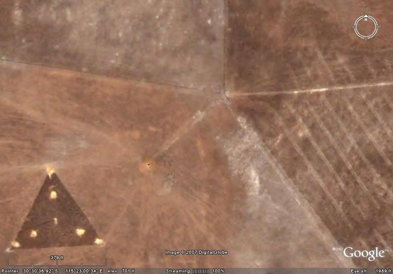
30°30'31.77"S, 115°22'42.14"E

A black triangle craft!

Hyperdimensional Blogging

11 (edited by lilmomma 2007-06-05 13:03:45)

Re: Strange happenings in Nevada Desert (google earth)

Bhang wrote:

Also: the Nazca lines in Peru are very crappy pictures, like they don't want us seeing them... and I can't get a good shot of Bohemian Grove (I can see my car on my street but I can't get down into the grove!... North and south poles are crumby imaging too...

Great program but as soon as I go looking for cool stuff I run into poor images. Here is a list that Jedimaster composed of interesting sites as well:

Great Pyramids: 29 58'35.71"N 31 07'57.14"E
Vatican: 41 54'07.00"N 12 27'25.51"E
Ground Zero: 40 42'40.00"N 74 00'44.00"W
Stonehenge: 51 10'43.54"N 1 49'35.21"W
Devils Tower(Close Encounters): 43 35'26.40"N 104 42'53.63"W
Chernobyl: 51 21'59.30"N 30 08'09.28"E
The Pentagon: 38 52'15.82"N 77 03'22.42"W
The White House: 38 53'51.54"N 77 02'12.58"W
Shanksville, Pennsylvania 40 01'06.09"N 78 54'30.00"W

Just copy the numbers and past them into the search of Google Earth, or Google Maps.

Aha!  I ran into the same problem while I was trying to look at The Hill of Tara and Rosslyn Chapel a while back.  I wondered what was up with that.  Here I thought I'd done something wrong. 

Thanks for posting all those other sites, Bhang.  It took me a while to find Stonehenge before.  You just saved me some time.  And sorry to hear about hacking, btw.  Hope you have a speedy recovery! smile

12 (edited by wandering1 2007-06-05 23:03:13)

Re: Strange happenings in Nevada Desert (google earth)

Bhang wrote:

quick note: copy above images!!! Google is airbrushing these things away!

also these coordinates are not in Nevada but this is still with a look on google earth:

30°30'31.77"S, 115°22'42.14"E

A black triangle craft!

Interesting.  It is a large black triangle in Western Australia.  Does someone feel like posting a picture of the image ?

Plus Google Earth is a cool tool.  Go to Google Earth and download the free software.  Then browse the Earth! (or at least parts of the Earth).

Several years ago, I saw a large black triangle for several minutes during the day outside the Denver Airport.  The person next to me saw it as well.  I had never seen anything quite like it. 

The one I saw near Denver could have been an atmospheric formation, a dimensional gateway, a craft, or perhaps all three.

Anyone else have an opinion on the black traingle that is currently showing on Google Earth?

Re: Strange happenings in Nevada Desert (google earth)

The triangle with the circle in the center is the sigil for sulfur. Sulfur is the transcendent chemical representing the multiplicity of human nature and the eternal aspiration to reach enlightenment. As indicated by the symbol, sulfur represents the triad of ascention – which can be viewed as a holy trinity. Sulfur is also one of the three heaveny substances in alchemical science (the other two being salt, and mercury).

My People Were Fair And Had Sky In Their Hair...But Now They're Content To Wear Stars On Their Brows

-Tyrannosaurus rex

Re: Strange happenings in Nevada Desert (google earth)

wandering1  wrote:

Anyone else have an opinion on the black traingle that is currently showing on Google Earth?

I don't think it's a craft.  There appears to be a tower (?) in the middle that casts a shadow but no shadow beneath it.  I have no idea what it is at all other than a 380' triangle out in the middle nomansland.  Weird!

http://img.photobucket.com/albums/v254/ … h/ge06.jpg

http://img.photobucket.com/albums/v254/ … h/ge05.jpg

http://img.photobucket.com/albums/v254/ … h/ge04.jpg

http://img.photobucket.com/albums/v254/ … h/ge03.jpg

http://img.photobucket.com/albums/v254/ … h/ge02.jpg

http://img.photobucket.com/albums/v254/ … h/ge01.jpg

15 (edited by Bhang 2007-06-06 20:28:43)

Re: Strange happenings in Nevada Desert (google earth)

"I don't think it's a craft. "

Well then I would ask we all review eye witness accounts and analyze the photos.

Thanx for posting the pics by the way!

[center]
Google Earth image:
[imgl]http://img.photobucket.com/albums/v254/ … h/ge05.jpg[/imgl]

I also wondered about the lack of a shadow but recall that many eye witness accounts report that these craft fly over at  low altitudes.

During the ensuing years (2000-2004), NIDS received hundreds of reports from people in the United States and Canada reporting large triangular aircraft, often silent and often flying at very low altitude and at low air speed. In many cases, the objects were brightly lit. NIDS files also include reports of Flying Triangles from remote areas.

http://www.space.com/businesstechnology … 40902.html

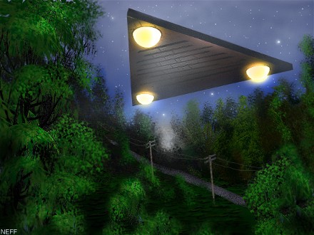
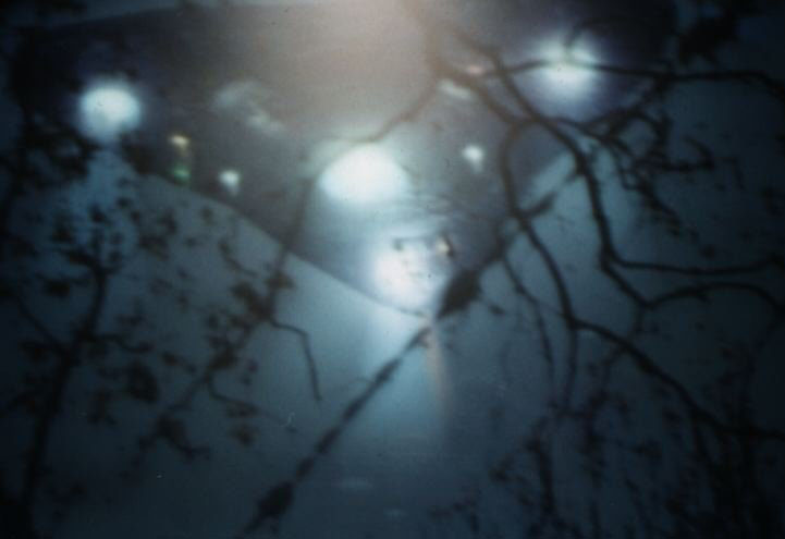
All most all accounts speak of there being three lights that are situated on the corners and a centrally located light (when the lights are on) as represented in these artist renderings and even photos:

Renders:
http://www.blackvault.com/wiki/images/Blacktriangle.jpg

http://community-2.webtv.net/ValSpegeln/CLOSEENCOUNTERSNEWS/scrapbookFiles/mailedD18.jpg

http://www.jerrypippin.com/UFO%20Bristol%20Tennessee%20triangle2.jpg

Photos:
http://www.coasttocoastam.com/timages/page/BelgiumTriangularUFO030305b.jpg

http://www.ufoarea.com/pictures/ufo2.gif

http://www.greatdreams.com/ufos/scotufotri.jpg

http://www.ttbrown.com/images/deltaft.jpg

[/center]

For a large database on triangle ufo eyewitness accounts, see: http://www.ufoevidence.org/Cases/CaseVi … n=Triangle

Hyperdimensional Blogging